


SEATTLE — Scattered rain and snow showers will linger around the Puget Sound area into Sunday, according to the National Weather Service (NWS).
Snow levels will hover between 500 and 1,000 feet during the day and drop below 500 feet at night.
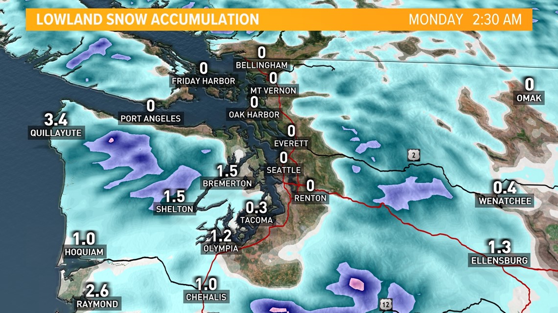
The Olympic Peninsula, the Southwest Interior and the lower Chehalis Valley have the best chance of seeing snow accumulations. The heavier snow showers will be "hit or miss" so any snow accumulations will be "highly localized," according to the NWS. Temperatures will make it hard for any snow to stick in most lowland locations.

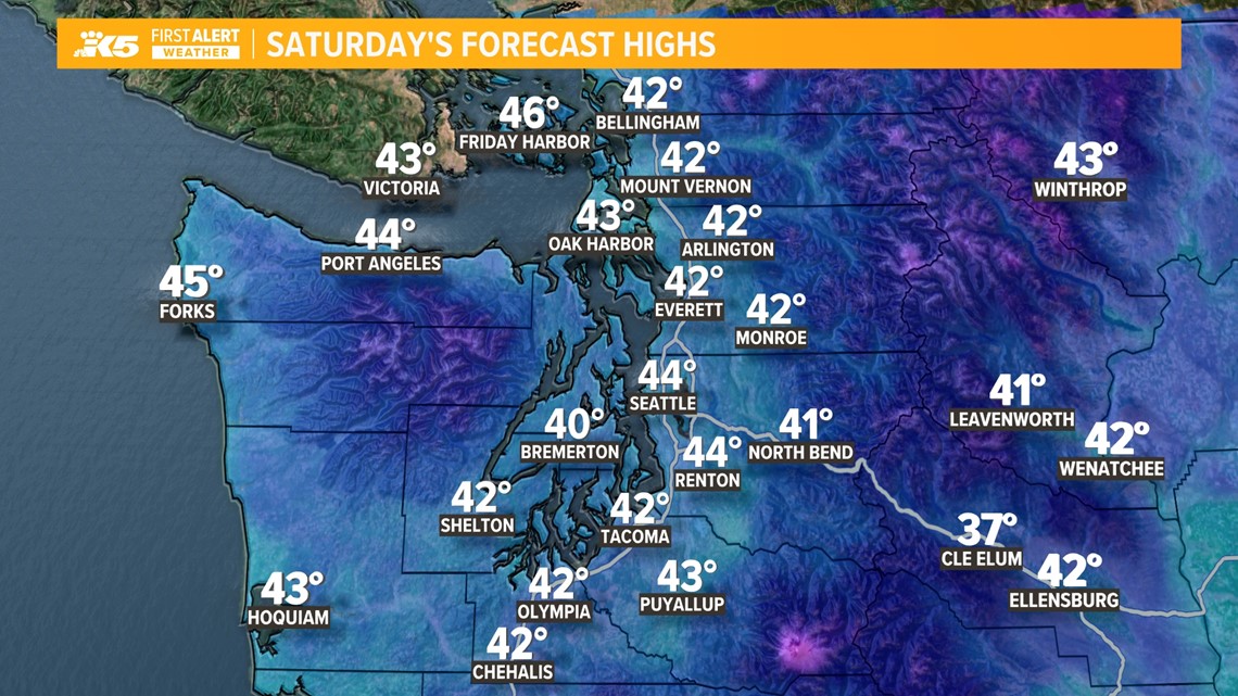
Temperatures will remain chilly, being several degrees below average for the first week of March. High temperatures will remain in the low to mid-40s, with morning low temperatures in the low to mid-30s, leading to isolated slick spots in areas that do get rain or snow, however, patches are expected to melt off quickly, according to the KING 5 Weather Team.

Moving into next week, temperatures and snow levels will remain low on Monday, but drier conditions are expected to develop across western Washington Tuesday afternoon into Thursday. While precipitation may dry up, temperatures are likely to remain below average throughout that time, according to NWS.
Conditions will improve in the mountains after several feet of snow fell earlier this week, however, elevated avalanche risk will continue at higher elevations. Avalanche danger is ranked at "considerable" for much of the Cascade mountain range, according to the Northwest Avalanche Center. Weekend mountain snow totals will likely be between 5 and 12 inches.
