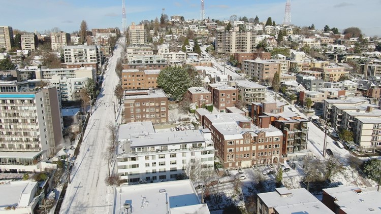
SEATTLE — Spots in western Washington saw trace amounts to one inch of snow after a mix of precipitation and frigid temperatures blew into the area.
Thursday afternoon, a modified arctic front will drop southward from British Columbia as cold air flowed out of the province. The "modified" arctic front was not as cold as a typical arctic front, but was predicted to lift and push the relatively warmer air currently over western Washington.
This caused temperatures to drop dramatically and produced a dusting of snow in several areas. Accumulations were generally light and spotty and less than an inch.
The areas with the best chances of accumulating snowfall were under a developing convergence zone band across northern King and southern Snohomish counties. Areas along the northern Olympic Peninsula were expected to see accumulations of 1 to 3 inches.
Bands of snow showers over the Southwest Interior will dissipate Friday.
The northern edge of a weather system moving into Oregon could possibly impact the Southwest Interior and the Central coast, which would produce some snow. Accumulations are expected to be an inch or less in most areas with the potential for more snow in Lewis County, according to the National Weather Service.
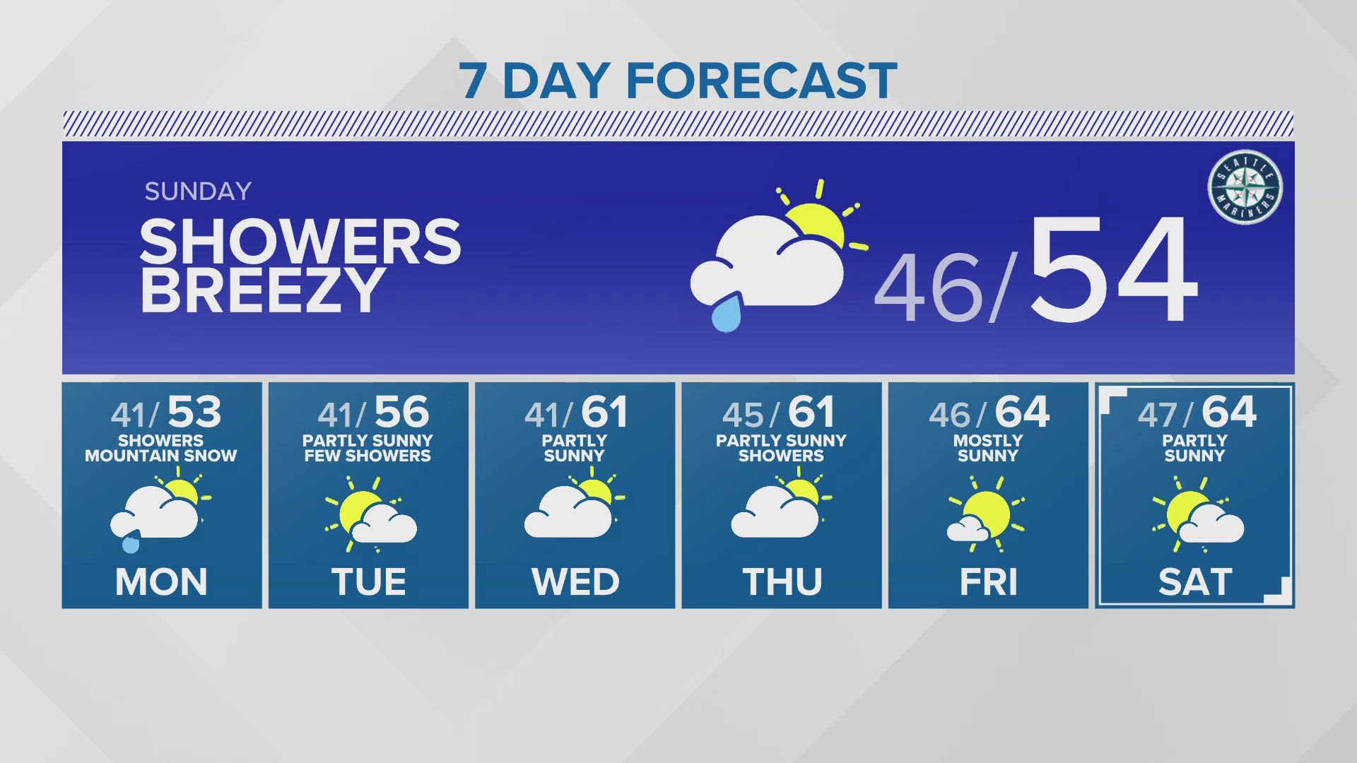
That weather system will continue to move to the southeast on Saturday. Sunday is expected to be sunny and cool.