

SEATTLE — The summer months around western Washington are statistically the driest time of the year.
While we expect dry conditions this time of the year, it has been unusually dry so far this summer. Seattle is currently experiencing a 33-day dry streak where Sea-Tac has not recorded measurable precipitation since June.
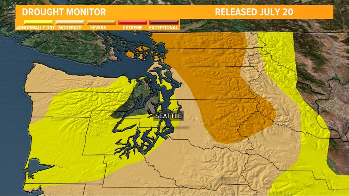
The region is not only experiencing a dry summer, but the entire first half of the year has been abnormally dry with most locations running several inches below normal. The dry conditions have allowed for parts of western Washington to slip into moderate and severe drought conditions according to the latest drought monitor that was released on July 20. The region has also been unusually warm this summer.
Latest drought monitor

The dry streak of 33 days at Sea-Tac will come to an end Monday as a strong storm system for the time of year sends a frontal system into the region.
This system will bring with it good moisture and lift to create a widespread band of light to moderate rain showers Monday morning into the early afternoon hours Monday with lingering spotty showers Monday evening and early Tuesday morning.
Rain timeline
Monday morning


Rain begins early Monday morning for coastal Washington and near the Strait. The rain will slowly shift from west to east across the Olympic Peninsula mid-Monday morning.
As the cold front approaches Puget Sound, the rain will move toward the Puget Sound lowlands, including in Seattle late Monday morning.
Monday lunchtime


Rain continues around lunchtime and early Monday afternoon for the Puget Sound lowlands, shifting into the Cascades and foothills.
Only spotty rain showers will continue back behind the cold front across the Olympic Peninsula.
Monday evening

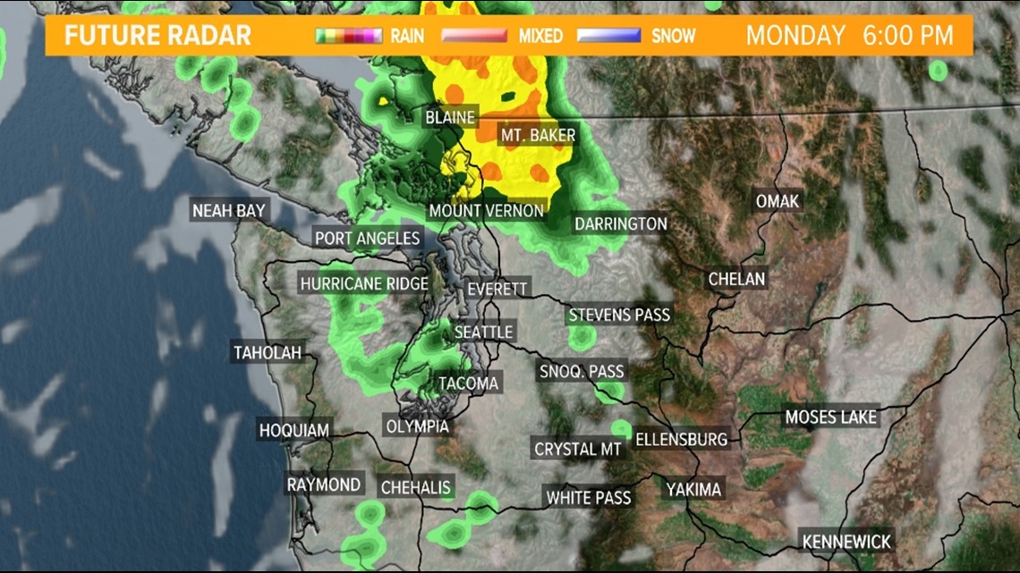
The rain begins to decrease in coverage late Monday afternoon and Monday evening for most of western Washington. The exception is for the San Juan Islands and Northwest Interior where areas of moderate rain are expected to continue deep into the evening hours Monday.
Rainfall forecast

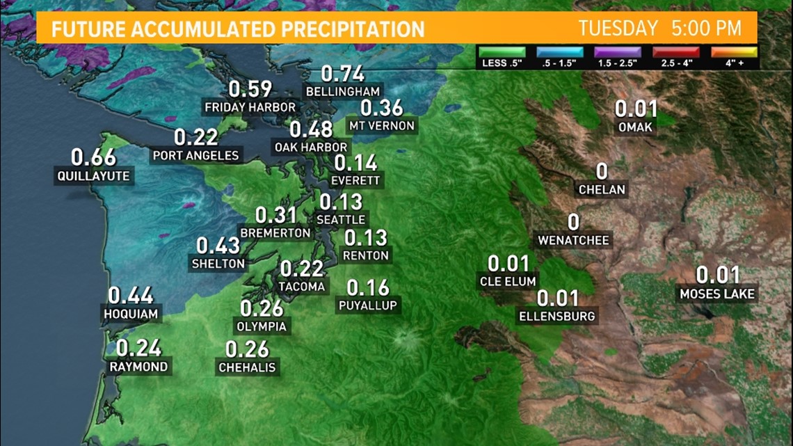
Most areas should record measurable precipitation on Monday.
The favored areas to see the heaviest rain accumulations will be for coastal Washington, the Olympic Mountains, the San Juan Islands and the Northwest Interior. These areas are expected to receive upwards of 0.50" with some higher amounts of 0.75-1.00" in the Olympics and possibly across the Northwest Interior, including in Bellingham. The rainfall record on Monday in Bellingham for a 24-hour period is 0.36" set back in 2015. This record could be in jeopardy as the current forecast calls for over 0.50" of rain for the city.
Light amounts are forecast in the Cascades, South Sound and the Southwest Interior where around 0.25" is possible. Central parts of Puget Sound, including Seattle and Everett, could see some rain shadowing from the Olympics that could prevent heavier rain from falling. Seattle and Everett are both forecast to receive less than 0.25" on Monday.
These rain rain totals won't put a dent into the ongoing drought conditions but every drop is beneficial and will help temporarily mitigate the elevated fire danger.
