SEATTLE — Storms and lowland snow were forecasted to arrive in western Washington Monday night, with impacts lingering into Tuesday morning.
A push of very cold air arrived Monday night which set us up for potential lowland snow in some spots.
It all started late Monday afternoon with an unstable air mass tracking over western Washington, leading to storms to pop up within a few heavier showers. Within these showers and storms, we also dealt with small hail, especially around Snohomish County, where convergence zone activity provided extra energy for potential storms. Lightning and thunder diminished not too long after sunset.
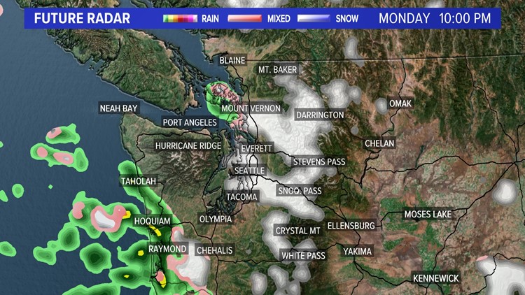
While storm chances faded, lowland snow developed as colder air settles in across Puget Sound. Initially, this meant wet snowflakes fell across parts of Snohomish County where the convergence zone was forecasted to set up.
The main timing of the snow started around 5 p.m. Monday and lasted until 10 p.m. Deeper into the evening, the system shifted southward bringing snow to parts of King and Pierce counties.
Snow accumulation
While there could be minor accumulations of less than an inch in spotty areas over Snohomish and King counties, most won’t see any at all. Also, expect the majority of accumulating snow to stick to grassy and/or elevated surfaces. Major roads and highways should see very little if any accumulations.
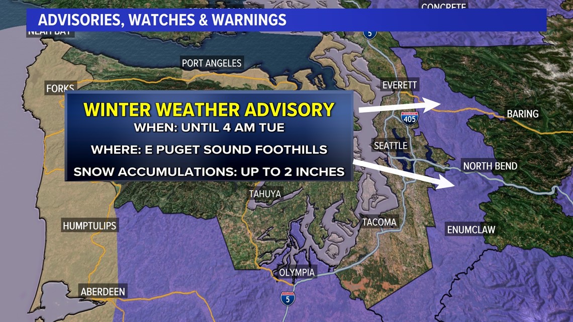
For those living in the east Puget Sound foothill communities, snowfall will have a higher chance of accumulating for anyone living at elevations above 500 feet. A Winter Weather Advisory was in place for those locations until 4 a.m. Tuesday for the possibility of up to two inches of snow.

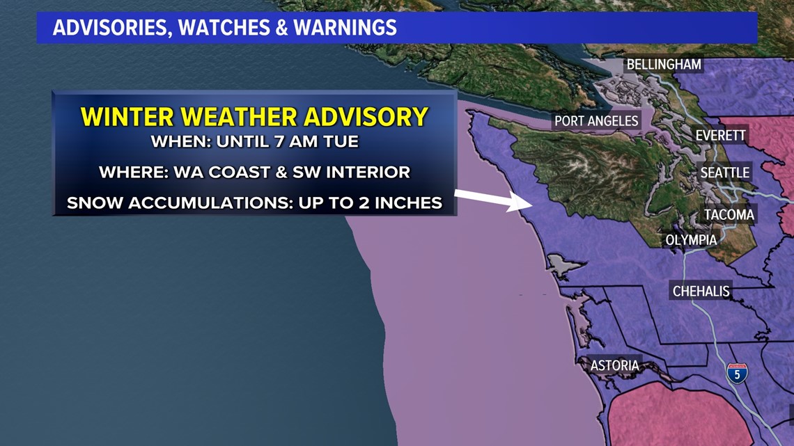
Better chances of accumulating snowfall will stay closer to the coast the later we go into the night, and it’s primarily the south coast that will see up to two inches of wet snow. Winter Weather Advisories were issued for the coast and extended inland to Thurston County until 7 a.m. Tuesday.

Mountain snow
Heavy snow will fall across the Cascades through the night with the heaviest snow predicted over the Central Cascades, where up to a foot and a half of additional snow could fall for Stevens and Snoqualmie passes.
By daybreak Tuesday, other than a few lingering snowflakes, most of the moisture should be gone, and we’ll begin to see sunny skies take over by late morning and through the afternoon as temperatures remain quite cold.