
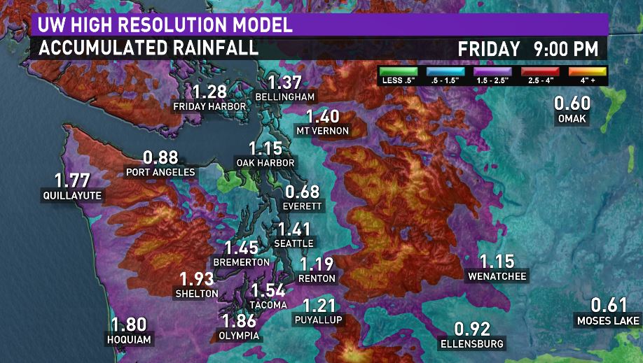
Heavy rainfall will move in this morning for the commute. Widespread moderate to heavy rain will hit Western Washington and continue until it turns to off and on showers later in the afternoon. It could bring an average of one-to-three inches of rain to the lowlands. It will be breezy in spots today around the lowlands. Area streams and rivers will rise but no significant flooding is expected. It looks like a few showers Friday into Saturday morning but then it should dry out and turn into a beautiful weekend. But it does looks like rain may return later on MLK Day.
The mountains will see heavy snow develop today but the snow level will run around 3,500 feet so most of the snowfall will be at Stevens and White Passes with a mix of rain and snow at Snoqualmie Pass through the day. Plan on poor travel conditions across the mountains by later this morning and then through the day.
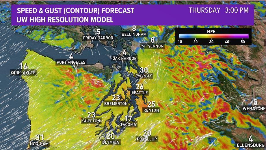
. There’s a High Wind Warning for the south Washington and northern Oregon coastline. Wind speeds could be as high as 30 - 40 mph around the mouth of the Columbia River with gusts upwards of 50 mph and higher. Central and north Washington coastlines will feel wind around the 20 – 30 mph range with gusts upwards of 45 mph and higher.
By Friday, we begin to slowly bring in a high-pressure ridge which will dry us out this weekend. By Saturday, we’ll begin to see sunshine and mostly sunny skies will move in on Sunday. Temperatures this weekend climb into the low to mid-50s.
